
*If they have a GPS and use the service
A heat map released by Strava this week has been making its way around the internet.
Many people have been saying it shows where cyclists actually ride, but as Jonathan Maus over at BikePortland.com points out the data is only collected from people who have a GPS device and use Strava.
Strava trends toward more affluent recreational riders as opposed to commuters and people who can’t or don’t want to buy a GPS device.
I’m a numbers nerd and like to log every mile I ride, but many don’t.
That being said, the map is still a lot of fun to look at. Here are some of the most interesting details.
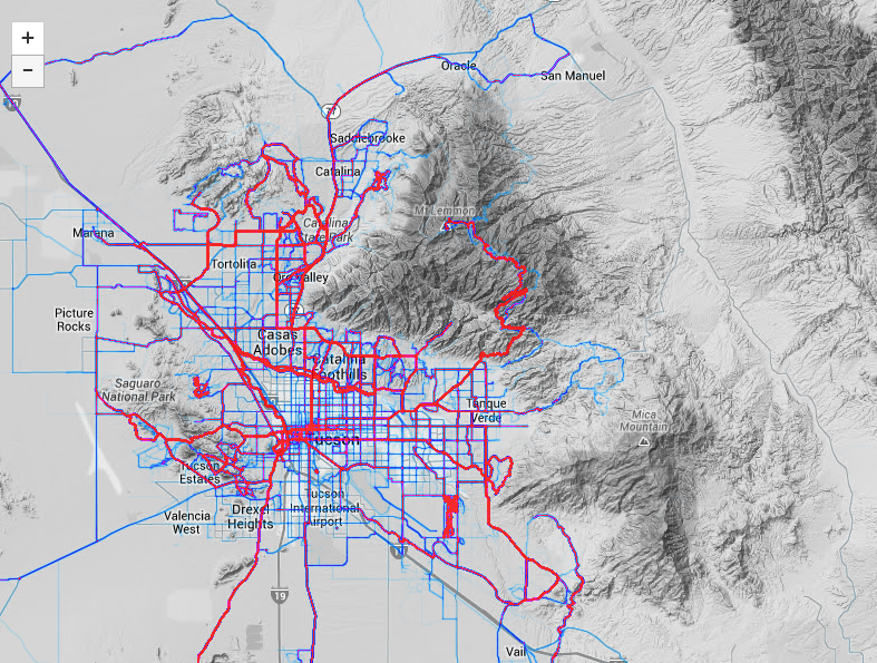
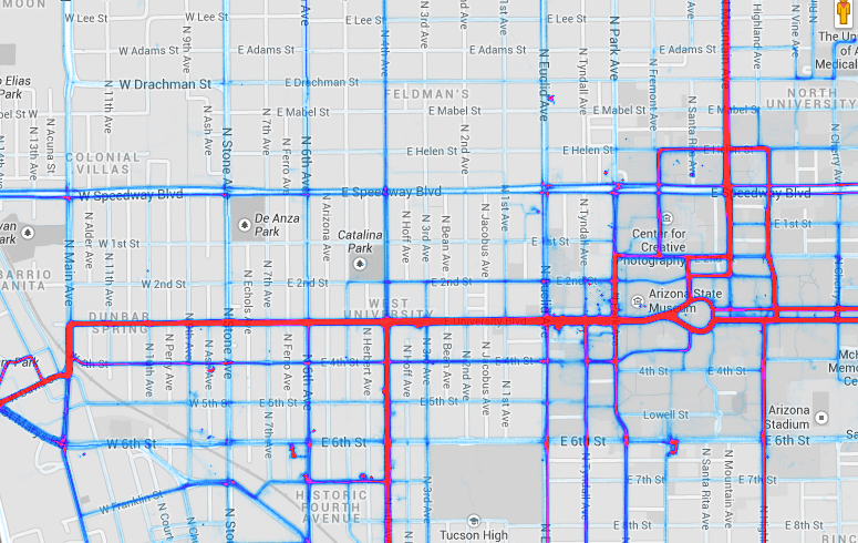
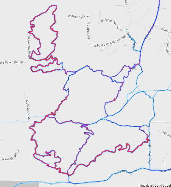
The darker red, the more people have ridden the route. From the whole Tucson view it’s clear there are some really popular routes including Mt. Lemmon, The Rillito River Path, Fantasy Island, Ranch Vistoso and the 4th Avenue/ University area.
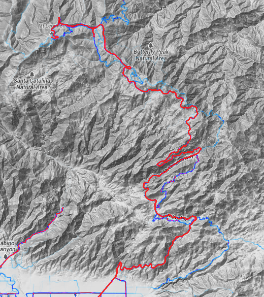
Here’s Mt. Lemmon
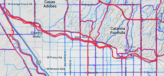
 And the Rillito:
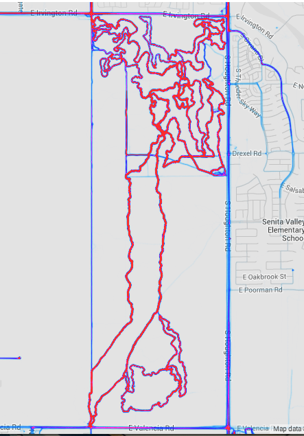
And Fantasy Island
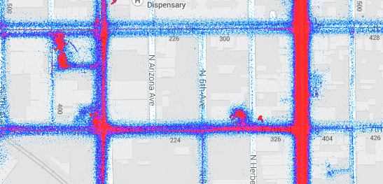
 Here’s the University and Fourth Avenue area:
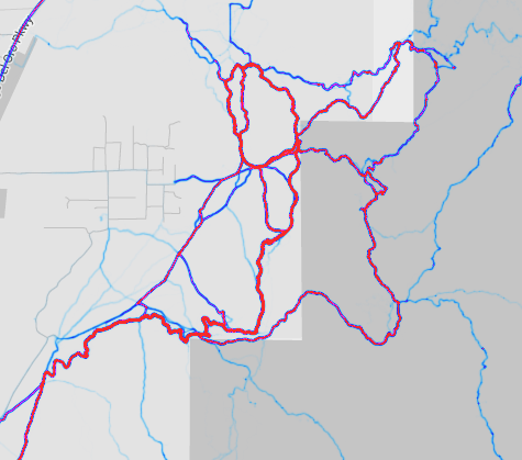
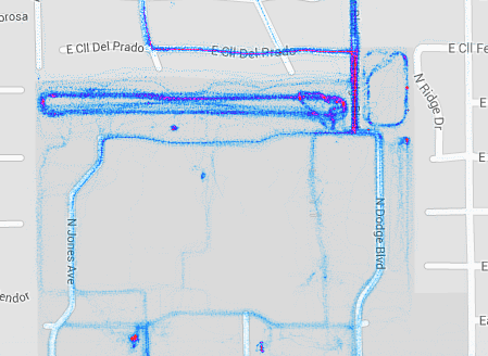
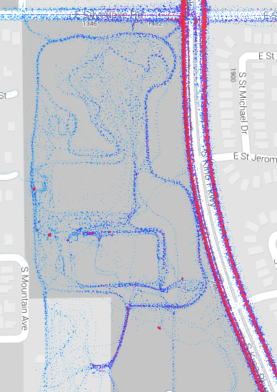
Here are some of the other mountain bike trail systems in the region.
Here’s the 50 Year trail system.
 Here’s the 24 Hour race
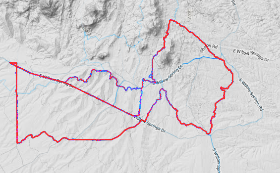
Here’s the Starr Pass network
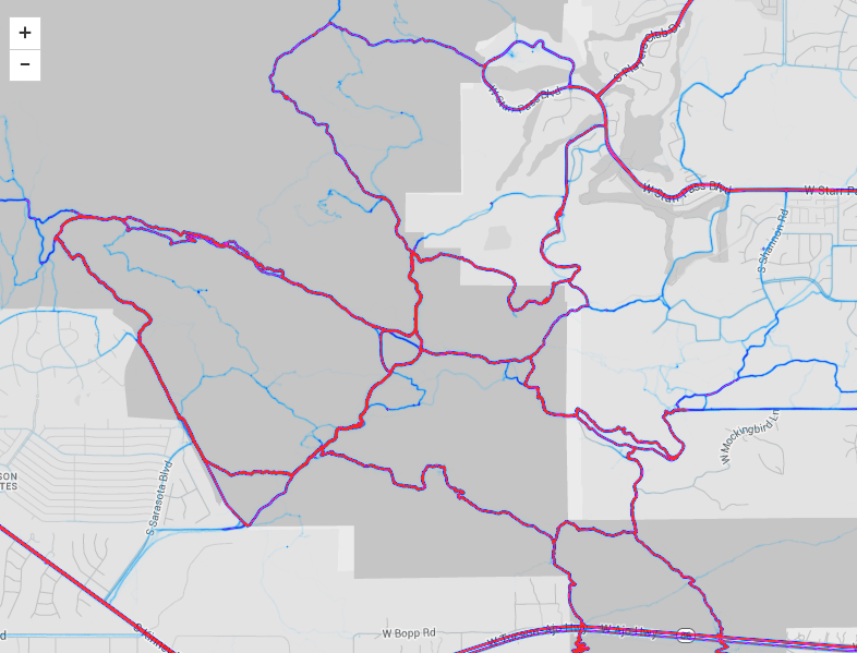
And lastly, the Sweetwater trail network
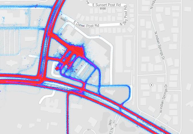
 Here are some other interesting sections of the map. It looks like someone is doing a little training in the parking lot of El Con Mall:
Here’s the Smackdown at Kino cyclocross race:
Here’s Le Buzz Cafe, a popular starting spot for rides:
You can also see collections of places for cyclists gather. In the photo below, you can see three groupings. The upper left is the old El Grupo clubhouse. The Lower left is Tap and Bottle/Exo Coffee. The bottom right is Ordinary Bikes.
Here’s Faiwheel Bike Shop.

Have a look at the map. Do you see any other interesting points?
Was looking at this the other day. You can see some suburban MTBing I wouldn’t have thought of. Like through washes and what not. And holy crap look at Grant Rd. and Oracle south of River. Such as waste.
Also, link to the sauce: http://labs.strava.com/heatmap/#11/-110.99703/32.27004/gray/bike
US 89 between Valencia and Green Valley is incorrectly labeled as I-19.
The heat just southwest of Kino Parkway and 36th is road training. Check it out on Bing maps birds eye view. It’s nice and convenient.
Whoops, totally missed the link in the post. Sory.
Se corner of Himmel park is a hot spot, performance bike in midtown is a hot spot as well.
Hermosillo!
And there is an around-the-mountain ride south of Caborca, in northern Sonora that looks pretty neat
It appears I-19 is labeled right, I-19 is the grey road road (obviously no cycling since it is banned in that area of interstate), the two routes on each side are Mission Rd to west and Old Nogales Hwy to east which get a lot of use. US 83 is east of Houghton Rd not shown on this map.
Oops. Didn’t see the actual link at the bottom of the post.
I’m not a Strava user btw. I do use Endomondo though, because they were doing the National Bike Challenge. The LAB took that over (too much demographic data to mine, they couldn’t resist (boo!)) so now I think Strava may work with it.
Sorry, thought I saw US 83, you put US 89, even so US 89 is in Utah
packersfantazUS 89 runs between Canada and Mexico (including AZ) and is a total blast. Rarely through-cycled in its entirety (most through-cyclists go west to east).
http://www.us89society.org/
packersfantaz
Nogales Highway, NOT Old Nogales Highway. There is an Old Nogales Highway, but that’s not the road you referred to. It’s a fairly common mistake. The Tohono O’Odham tribe has signs on their land noting the Nogales Highway as “Old Nogales Highway.” Also, the El Tour De Tucson maps, and T-shirts, had it incorrectly designated for years. In fact, I called the Perimeter Bicycling Association once to tell them they had it wrong and the guy said I didn’t know what I was talking about. The fact that I lived down there and drove on both the Nogales Highway, AND the Old Nogales Highway every day for years didn’t count for anything in his opinion. Here’s another potential item that will probably cause problems, Google Earth now has the Nogales Highway marked as I-19B!
It was fun to see Red Star’s heat spot.
Awesome! I saw this Heat Map the other day last week… and posted on FB… hoping you would notice it and do a story on Tucsonvelo…
another insight- the HAWK light on Alvernon between 22nd and Broadway is at the wrong spot- it should be either farther south or farther north based on where folks are biking and running
thomasmeixner That’s true as it is now. Ideally a path would get put in across the golf course. If installed between the two courses it would cause little disruption to the golfers. It would have to be fenced on both sides, and have grade separation where it crosses cart paths.