
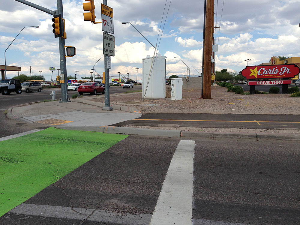
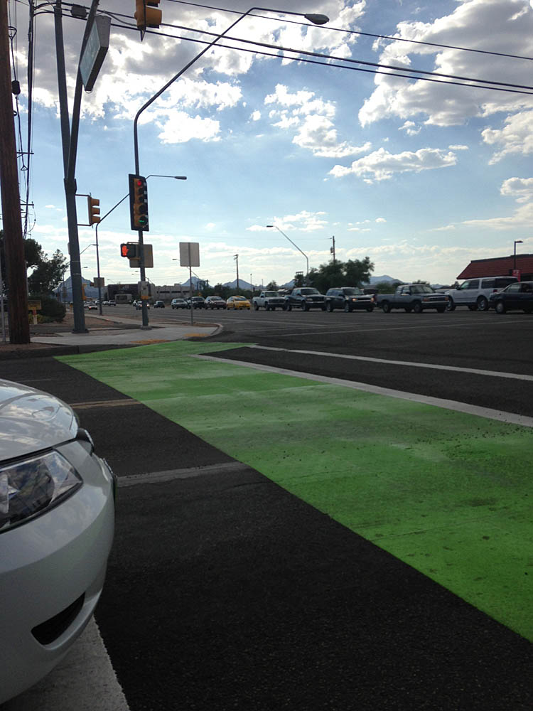
New green pavement popped up on Tucson’s south side last week.
Pima County’s bicycle and pedestrian program manager Matt Zoll said the thermoplastic is part of a Loop path stretching from the Veterans Administration Hospital to the Kino Sports Complex and Sam Lena recreation area. (See map below)
The path utilizes the crosswalk at Park Avenue and Ajo Way to connect to a path in a diversion channel.
Zoll said the thermoplastic was used to highlight that bicyclists will be using the crosswalk and motorist should use extra caution.
Check out the map to see the approximate location of the path.
View Diversion channel path in a larger map
You mention the green marking, but fail to mention the new section of path they installed along the south side of Ajo Rd. between Park Ave. and the VA hospital. The new section of path is the EXCITING part.
3wheeler Are you saying I can finally ride from Park & Ajo to the Kino Hospital complex without getting off the bike and carrying it thru the sand in the concrete wash??
3wheeler oh, guess not– sounds like you are talking about west of Park and I’m talking about east of Park.
I don’t buy that line cutting through the back of the VA hospital.
StrawHousePig It’s in the planning phase. I should have used a different color. Here’s the Loop map: http://webcms.pima.gov/UserFiles/Servers/Server_6/File/Government/The%20Loop/130607%20Loop%20Map%201.pdf
MikeMcKisson StrawHousePig
I didn’t look at the map you posted with this article when I first read it. You marked the path location wrong. It’s not correct for either the current condition, or for the proposed route. The current path extends West along Ajo to 6th and turns North there. The proposed route crosses Ajo at the wash, near Park, and follows the wash until it reaches the East fence of the VA. It then turns North to the North edge of the VA and turns West to 6th. The path does not currently run in the wash through the VA, and the proposed route is not shown in the wash through there either.
3wheeler MikeMcKisson StrawHousePig This is based on you riding it? I didn’t get to ride is and was visualizing based on a phone conversation.
I was told it headed north just past the train tracks, but looking closer the proposed part does go north of the VA hospital.
That is moot anyway…
MikeMcKisson 3wheeler StrawHousePig
A) I have ridden it. B) My description matches the LOOP map for both the existing and proposed paths. C) The existing path is visible on Google Earth.
3wheeler I’m not arguing with you. I’m trying to clarify where the path goes since I know you ride it a lot.
I was told the path cuts north just west of the train tracks. Clearly that isn’t the case.
The map has a section that is in planning that utilizes the diversion wash and goes north of the VA.
Thanks.
MikeMcKisson 3wheeler
I’m sorry, I wasn’t trying to be snippy. The proposed path runs as I said in my first comment on the map, except I was wrong about it running along the East side of the VA fence. It is proposed to cross Ajo at the wash, just West of Park Ave., and run along the edge of the wash until it reaches the East side of the train tracks. Then it turns North and does a few wiggles thru the commercial area there and turns West just short of the freeway off ramp. I don’t know how they hope to get it to 6th Ave. from there. My guess is they think the feds will let them have a slice off the North end of the VA property. One thing that’s clear, the path will not go in the wash. I can show you this if you want to meet.