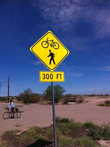
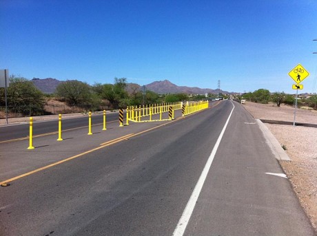
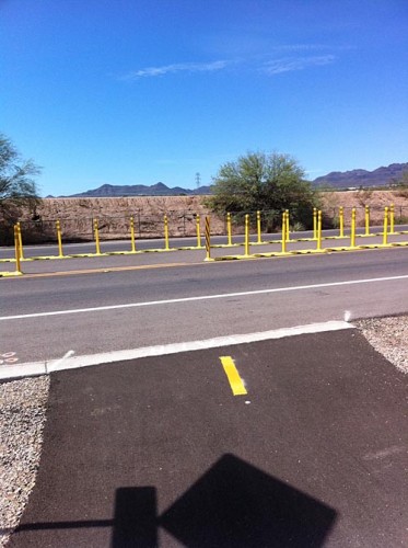
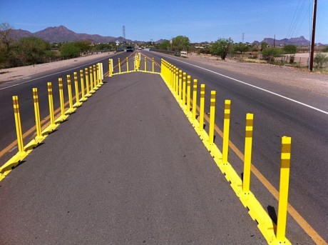
The City of Tucson added a new two-stage crossing on Camino del Cerro to help Urban Loop users get across the road.
According to Tom Thivener, the city’s bike and pedestrian program manager, the crossing cost about $15,000 to design and install. The money is from the RTA.
Here’s what it looks like from a motorist’s perspective:


Here is what the crossing looks like for cyclists:


When was this installed? I went through this yesterday (twice) and thought “wow, that’s cool”. It was my first time riding on that path and the crossing was a pleasant surprise.
I was not as thrilled with this. Southbound, it directs you on the bridge sidewalk, which feels like it’s about two feet wide. Two-way bike traffic is definitely out of the question. I’ll be using the road next time, once I wait for the westbound cars to clear the new obstacle.
The concept (bike refuge/bike island) is good and sensible, but why not use Jersey barriers (aka K-Rail)?
The concept (bike refuge/bike island) is good and sensible, but why not use Jersey barriers (aka K-Rail)?
This crossing is not unlike a lot of the river path system. It’s semi high context. The first time you go through it you have to go slowly and figure it all out. I rode it Sunday late afternoon. It’s a lot better than the first time I came through. I got lost and headed north on the west bank for a mile before I figured it out and just headed toward I-10 and found the real path. The sea of yellow on the bridge makes it a lot more obvious I accept that the bridge crossing is a compromise and not a terrible one. I like it even if it isn’t the end all be all of trans bank, trans roadway bicycle path transitions.
Question: south side of Camino Del Cerro, the approach is pretty steep. Does the slope meet ADA guidelines? Imagine trying to look east for traffic at the eye level of a wheel chair user on an incline.
I was mystified the first time I encountered this palisade of plastic markers. It was dark and the thing hadn’t been there the last time I rode thru there a week before. Once I figured it out, I think it’s OK. I agree w/ Red Star that it could be a better physical barrier against cars, but it’s alright as it is. They may make it more substantial later or maybe they’ll run the path along the river and route it under the bridge like most of the other river path street crossings.
As for the bridge, I’ve ridden my trike on the south sidewalk on the bridge a half dozen times now and I haven’t had any problems w/ the width. My mirrors need 39″ clearance and I felt like I had plenty of room. Dan is right, simultaneous, two-way traffic is not an option. I’d love to have a dedicated cycle/ped bridge across the river but this is fine for now.
Over all, I’m lovin the new connector section and plan on riding it again tonight. Mile and miles of virtually non-car riding!
You know… Because they need to make it break away easily so inattentive drivers won’t get hurt or their cars damaged as they plow through it at speed. 🙂
[…] you missed it, be sure to check out the new two-phase crossing we wrote about yesterday. AKPC_IDS += […]
There seems to be no restrictions, so why did they create the jog in the crossing?
The access path on the south side could have been located directly across from the continuation of the path northward creating a direct crossing.
Then, it would be a candidate for a HAWK. If unaffordable now, maybe in the future. This skeletal PELICAN seems unnecessarily awkward.