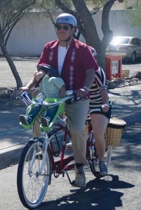
 If Sunday’s Cyclovia Tucson demonstrated one thing, it was that there are thousands of Tucsonans who like to ride their bikes.
But many of those who turned out on Sunday might not feel comfortable riding when the party is over and the roads are opened back up to traffic.
Recently I was standing with an acquaintance in Reid Park when we saw a young woman riding south on Country Club Road, which has zero bike facilities.
She was pedaling as fast as she could and looked panicked. My acquaintance muttered, “Doesn’t she know she doesn’t have to ride there?”
We live in a region that provides cyclists options for getting places around town. But many people, especially newer bike riders, aren’t familiar with those alternatives.
For the most part, motorists are only familiar with the roads they drive on and the bike lanes that hug the sides of those roads. But for many people who are considering riding, bike lanes on busy streets don’t look appealing.
How would a motorist who drives across town everyday on Speedway or Broadway Boulevards know that the Third Street bikeway exists?
Here are a few options for routes around Tucson that have light traffic and offer a Cyclovia Tucson feel every day of the year.
Rillito River: A continuous car-free bike and pedestrian path which stretches from I-10 to Craycroft Road. There are a few businesses, including Trader Joe’s and several parks with easy access from the path. This is the first place we went riding with Luci when she was six-months old. We went back and forth along this stretch for months before taking her on a road with cars.
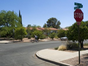
Third Street: Third Street is the most popular bikeway in the region because it is a low-stress way to access the University of Arizona area. It stretches from Campbell Avenue on the west to Wilmot Road on the east. It follows quiet neighborhood streets through Tucson and prevents all non-local traffic from using it as a cut-through street. Check out the interactive map below to follow the route. West of the University, this road turns into University Boulevard, which has more traffic, but is still a decent route.
Cactus/Treat Ave: This north-south route stretches from the Rillito River path on the north to the Aviation bike path on the south. Although there isn’t a great way to get across Broadway Boulevard, it does have bike-friendly crossings at the other major intersections. This would be a great way to access Reid Park and the zoo.
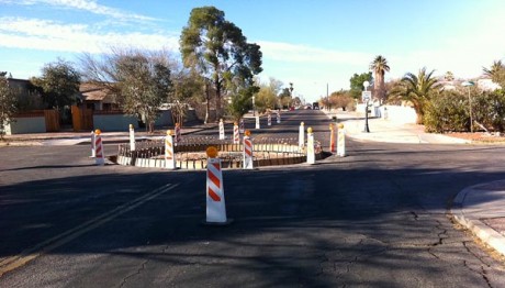
Fourth Avenue/Fontana Avenue: This north-south route will become Tucson’s first official bike boulevard and stretches from University Boulevard on the south to Prince Road on the north. The bike boulevard will prioritize bicycle travel and prevent motorists from using the route as a cut-through street. It also provides nice access to the 4th Avenue-area shops and restaurants. Once south of University and around the shopping district, there is a substantial increase of motor vehicles and obstacles. Use care riding in that particular section. You could park your bikes at one of the bike parking corrals and walk the busy stretch of Fourth Avenue.
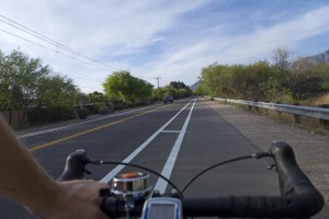
Mountain Avenue: This route has the most traffic of any of the routes on the list, but is also one of the most popular routes for bicycles because it connects the University of Arizona to the Rillito River on the north. Between Speedway Boulevard and Ft. Lowell Road, the route features a bike lane that is buffered from traffic by several feet of bricks. From Ft. Lowell to the Rillito River, the bike lane is decent, but not as roomy as the southern stretch.
Blacklidge Drive: This east-west route connects to several north-south routes including Treat Avenue, Mountain Avenue and Fontana Avenue. It has a bike/pedestrian crossing at Campbell Avenue and starts at 10th Avenue on the west and Columbus Boulevard on the east. This route can get you to Beyond Bread, Sauce, an Albertson’s grocery store and Nico’s Taco Shop.
Lester Street: This east-west route connects Mountain Avenue and the Fourth Avenue bike boulevard, which allows cyclists to avoid the busier section of University Boulevard.
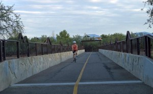
Santa Cruz River: The Santa Cruz River path is another car-free bikeway, which starts at 29th Street on the southern end and continues north to Grant Road, although construction is underway to stretch the path all the way to Ruthrauff Road.
Aviation Path: The Aviation bikeway is another car-free route which starts just outside downtown Tucson and continues east to Kolb and Escalante Roads. There are several points where the path crosses major intersections via a crosswalk, which requires caution.
View Low stress bike routes in Tucson in a larger map
Those are a list of my favorite low traffic bike routes. Do you have your own low-stress routes that I didn’t list? Add yours to the comment section.
Also check out the map sent to me by a reader. It shows family-friendly intersection crossings throughout the entire region.
View Safe Bicycle Street Crossings in Tucson AZ in a larger map
Lastly, download the region’s bike map to help find a route. The green routes are considered low traffic streets and more often than not provide bike/pedestrian crossings at major roads to help people get across.
Please consider sharing this with some of your friends who may be considering riding their bikes more. Bike to work week might just be the motivation they need.
And check out Tucson Velo and Chris Hinkle Photography’s photo booth images from Cyclovia here.

Don’t forget that Living Streets Alliance has “family fun rides” once a month where we take a group out on a Saturday morning to ride on exactly the kind of routes where families can feel most comfortable! Our next ride is April 30:
http://www.livingstreetsalliance.org/category/events/
Thank you for this great resource.
I have always felt more relaxed while cycling because I have a rear-view mirror on my helmet. Being able to see the car coming up behind me allows me to ride more calmly and safely, even on a busy street.
If you want the up-to-date map, you can get it here: http://bikeped.pima.gov/Publications.html
Great follow-up story to Cyclovia, Michael! Thanks.
Liberty street heading south is one of my favorites. For heading south of course.
Have they finished the construction on the Rillito River Path approaching the interstate? Last year, I was unable to ride all the way to I19. Thank you!
The Arroyo Chico route is a mellow alternative to either Broadway or 22nd from Campbell to at least Wilmot.
3rd Street needs to be repaved SO BADLY… from Campbell to Country Club it is gnarly and the cracks in the asphalt are dangerous as they basically act as traps for skinnier road tires. For a street with such heavy cycling and minimal cars, the City of Tucson needs to step up their game. Same thing could be said for 4th ave. all the way to the underpass.
Mike, your site made Google news!!!!
Many more ‘low-stress’ facilities are in our Region’s long range transportation plan. This map illustrates the urban loop and 40 Bicycle Boulevards within the loop, as well as some of the bike friendly collector streets. Many of the Bicycle Boulevard corridors are already nice to ride on. The lack of signalized crossings and some of the busy streets today make them only partially low-stress. http://cms3.tucsonaz.gov/sites/default/files/bicycle/BikeBlvds_Aug2010.pdf
I take exception with 4th Ave. being considered a bike friendly street. It is heavily used by bikes and bikes have high visibility there, but there are too many injuries occurring and hazards present to classify as ‘low stress’. Lots of cars, door openings and wandering pedestrians. The fact that incidents of injury and property damage are seldom reported is allowing the city to downplay the true conditions. I think it is a disservice not to warn less than experienced riders about 4th Ave.
The paths around Randolph golf course and Reid Park are very nice, and a good way for people in the surround neighborhoods to get to El Con.
I would also continue Lester Street to Campbell, where it meets up with Elm Street, which is quiet and easy until Country Club or so.
Also, I have a question about Treat Ave south of Broadway–one used to have to detour along Stratford or Eastbourne as Treat became a pedestrian-only path for about a half-mile. Is this changing?
Thanks for the comment, ZZ. You are right about the section of Fourth Avenue between University and 10th.
I was speaking about the area north to Prince as being low stress. I’ll add some language to make it more clear.
Agree. The 3rd Street segment you mention is a disgrace and the neighboring work-around streets are almost as bad. And yet 3rd Street is one of the most heavily-used bicycle routes in the Old Pueblo. And there is no effort, not even middle school-level experiments, by City of Tucson to correct this. What say you, Tom Thivener?
Enjoy the artwork, the litter, the decay and neglect and City of Tucson indifference along that sham career-builder referred to as “Aviation Path.”
Great article, Mike! This is exactly the kind of info we need to get out to new and would-be riders. And the timing couldn’t have been better. With the BAC and LSA, we hope to spread the word about the bike-friendlier alternatives that already exist in our city. Sure we’d all appreciate better paved roads, and we know over time we’ll get them, but I’d still take (and do take!) Aviation or 3rd Street over a road shared with cars any day!
3rd street is terrible. It is a bone jarring teeth rattling experience even on wider tires. If the city wants to get a big return on investment, repaving this highly traveled section of road would be the place to start. And while they are at it, all those stop signs slowing progress for bicycles on the route need to be removed.
I live just east of 4th Avenue. The bike boulevard is still under construction, but I have noticed that the cars no longer go barreling up and down 4th. And that’s a good thing. The less idiotic driving, the better.
Agree, localmusicfan. 3rd Street through Sam Hughes neighborhood might be a good segment for City of Tucson/Thivener to try 6′, maybe 9′ of bicycle repaving down the middle of the aging road, assuming they can do it right from a cost and durability standpoint. Curb-to-curb repaving probably won’t happen on this segment because of cost and disruption of the 3rd Street parking lot. Keep in mind that Sam Hughes goes out of its mind if so much as a wild pig or two show up:
http://samhughes.org/
scroll down to:
“Preventing Conflicts Between Dogs and Javelina” for some myopic fido- love.
Rational, state of the art stop signage? Isn’t there someone at COT responsible for that? What is her name and why isn’t getting the job done?
Also great, and suprisingly little used: The multi-use path along Golf Links… as far as it goes. Really, the only problem with it is that if you need to go farther east than Wilmot, you’re suddenly committed to dealing with Golf Links traffic. Still, if they would just repave the bike lanes in that area (particularly the eastbound one, which is truly deadly), it wouldn’t be a bad ride.
I don’t know when they started work on the Santa Cruz extension, but it’s looking great! With only a couple short unpaved sections, it’s now paved north from Grant road (on the west bank) well past the Silverbell golf course. Rode the path today, and I finally had to turn around at a spot where they’re building a bridge over a wash. But I could see that it’s already paved on the other side of the wash, perhaps all the way up to Cmo. de Oeste / Ruthrauff?
Anybody know if there are any plans in the works to connect the Santa Cruz path between 29th and Ajo, so that the path includes the section between Ajo & Irvington?